Delta suite aero

The AERO version is the C4ISR version of the DELTA SUITE software, published by IMPACT. This version is used in operation by the French Special Operations Command.

presentation

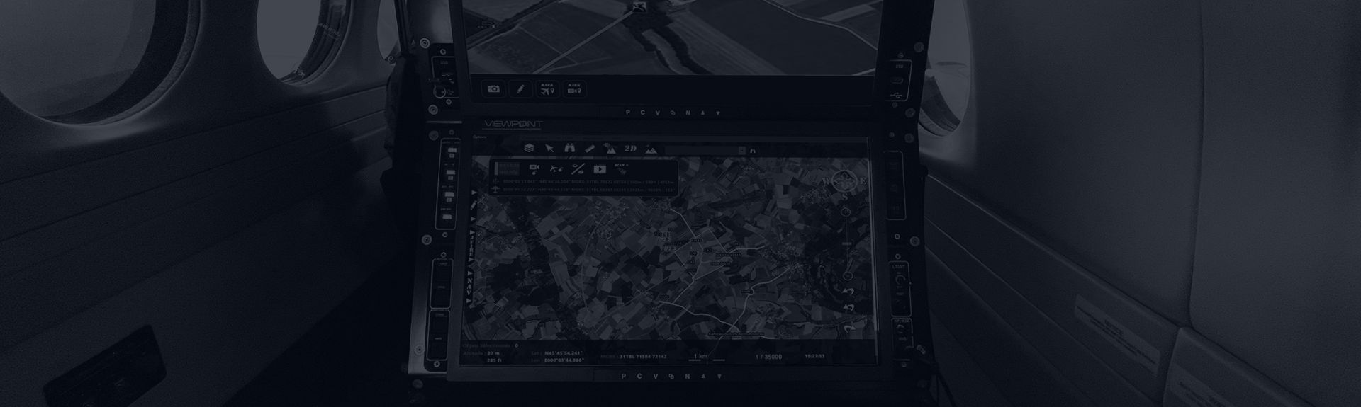
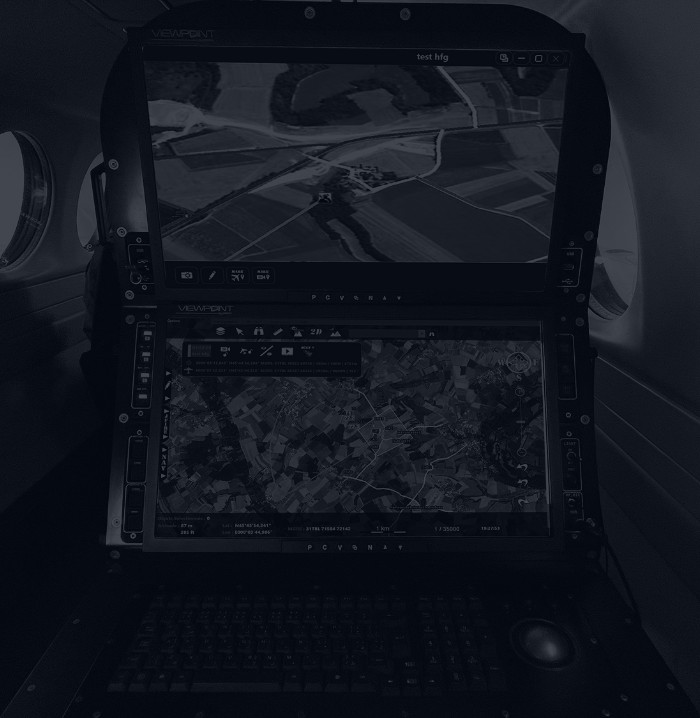
The DELTA SUITE AERO is the version dedicated to the control of optronic systems on board aircraft. Several specific applications, detailed below, are available in this version.

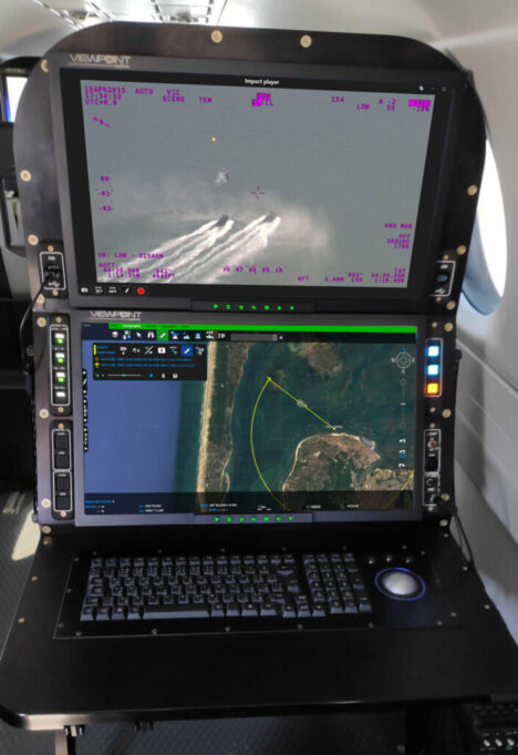
In addition to the standard functionalities common to the other versions, the DELTA SUITE AERO offers a set of advanced tools to optimize the operation of ISR sensors (augmented video, bleaching mode, SLEW mode, etc.).

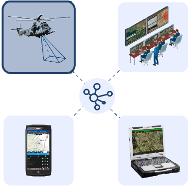
In terms of communications, the exchange of data between different DELTA SUITE-equipped stations is possible through the use of multiple compatible communication means. The overall tactical situation can thus be shared with a command center, another aircraft or elements on the ground.

In addition, compliance with military (VMF, COT, etc.) and civilian standards and protocols allows for increased interoperability of the solution with third-party systems.
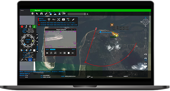
Download the datasheetchevron

“ MAPPING ” SPECIFIC APPLICATION: DATA INTEGRATION AND FIELD ANALYSIS

In order to allow a quick synthesis of the most important information, the user has a permanent access on the main display, and the hereafter functions and information:

  • Display of coordinates (MGRS, long/lat…) and altitude, elevation (meter and feet)
  • Graphical scale (metric/imperial)
  • Local / Universal time
  • Map interaction tools
  • Drag and drop import capabilities of numerous geographic data formats (GeoTIFF, JPEG 2000, ECW, DTED/DMED, Shapefile, KML/KMZ, NITF, S57, USRP, ASRP, Mr Sid, AML, GeoPDF) and connection to web mapping services (WMTS, XYZ, TMS)
  • Drawing of vector objects
  • Layers Manager
  • Basic and advanced search tool
  • Slope profiles and line of sight calculation, geofencing tool
  • 2D / 3D view toggle

“ IN/OUT ” SPECIFIC APPLICATION: DATA EXCHANGE AND EXPORT IN MULTIPLE FORMATS

This specific application provides the following features:

  • Export of objects to any other user in the network
  • Import of objects sent by any other user of the network
  • Monitoring of uploads and peers
  • Export in multiple formats (SHP, KML/KMZ, JSON, GPX)
  • Snapshot of one or more layers
  • Import of cartographic and vector data by folder
  • Configuration of map servers

SPECIFIC APPLICATION “ MOVING MAP ”

In order to allow a quick synthesis of the most important information, the user has a permanent access on the main display, and the hereafter functions and information:

  • Choice of the type of orientation of the view (camera, fixed north, free...)
  • Comments input (logbook)
  • Displaying information about the target
  • Display of the camera orientation in azimuth and elevation
  • Management of multiple sensors simultaneously
  • SLEW mode (depending on sensor) = camera alignment
  • Display of aircraft position, track, target, footprint and camera-target segment
  • Mission replay
  • Whitening mode allowing to visualize the already observed areas (color code according to the number of passes and the time of observation)
  • Augmented video with overlay of vector data in the video window
Options Produit

OPTIONS

Optional modules can be added to enhance the functionality of the DELTA SUITE

Integration of MAGELLIUM's algorithms to automatically recalibrate the video to reference images (under certain conditions) and to ensure automatic detection and tracking of moving targets (under certain conditions)


Instant messaging tool, point to point or in server mode (XMPP standard)


Any questions, an issue?