Delta suite android

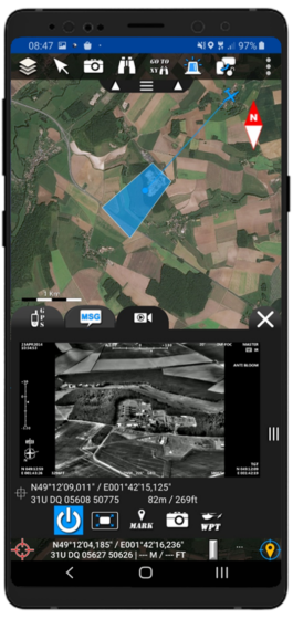
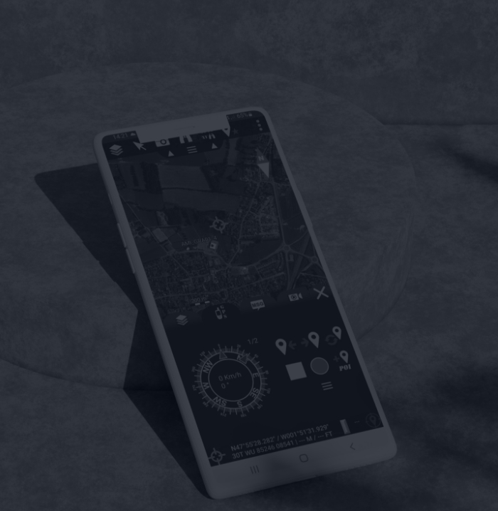
Mobile version of the Delta Suite, running on Android. Allows a fast use, while keeping advanced functionalities of data exchange and situation monitoring.

presentation

The DELTA SUITE Android, a light and intuitive tool adapted to use on a smartphone or tablet, provides access to specific applications similar to the Windows versions (navigation, communication, visualization and interaction with geospatial data, video flow management, etc.) with which it is fully interoperable.

Provided that compatible means are used (LTE, Wi-Fi, tactical radios, GoTenna, etc.), the overall tactical situation can be shared with a command center, an aircraft or other ground elements.

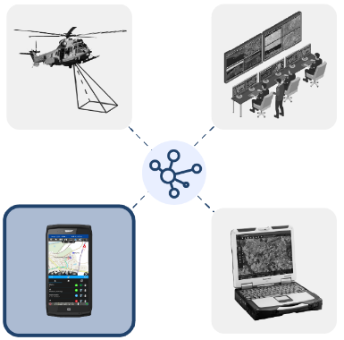
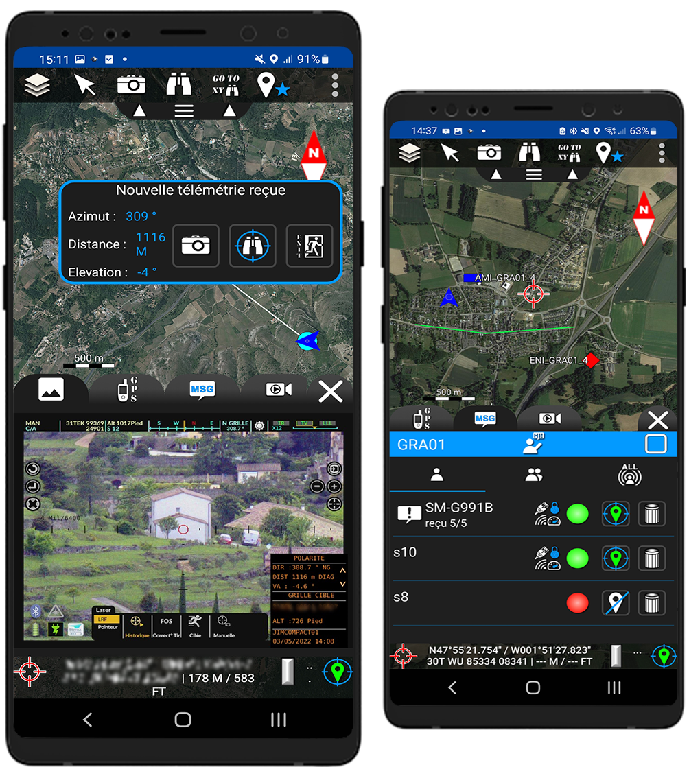
In an intuitive graphical environment, the merged information from the various sensors provides users with a complete vision of the situation while offering a dynamic messaging tool with all the other actors.

Download the datasheetchevron

“ CORE ” FUNCTIONALITIES

In order to allow a quick overview of the most important information, the user has permanently on his main display:

  • Display of coordinates (MGRS, long/lat…) and altitude, elevation (meter and feet)
  • Graphical scale (metric/imperial)
  • Rotunda of interaction with the map
  • Import capabilities of numerous geographic data formats (ECW, Geopackage, MBTiles, SQLite, TMS, GPX, KML, JSON, DTED, CoT) and connection to web mapping services (WMTS, XYZ, TMS)
  • Blue Force Tracking)
  • Data exchange capability
  • Photo or video tool

SPECIFIC APPLICATION “ NAVIGATION ” :

This specific application provides the following functions:

  • Automatic connection and configuration of GPS
  • Retractable pull-out with all essential information (compass, heading, speed, distance to next waypoint)
  • Waypoint, route and point of interest management
  • Recording of tracks
  • Trackback
  • Guidance to a moving object

SPECIFIC APPLICATION“ FULL MOTION VIDEO ”

Provides real-time video exploitation capabilities (FMV)

  • Stream reading in UDP, RTP, RTSP, HTTPS, HTTP
  • STANAG 4609 compliant stream decoding (display of vector, target and footprint position)
  • Choice of the type of orientation of the view (camera, vector position, free...)
  • Add point of interest
  • Snapshot with point of interest positioning
  • Advanced integration with the Black Hornet drone (sending waypoints to the drone, retrieving photos taken by the drone)
Options Produit

Any questions, an issue?