Delta suite nomad

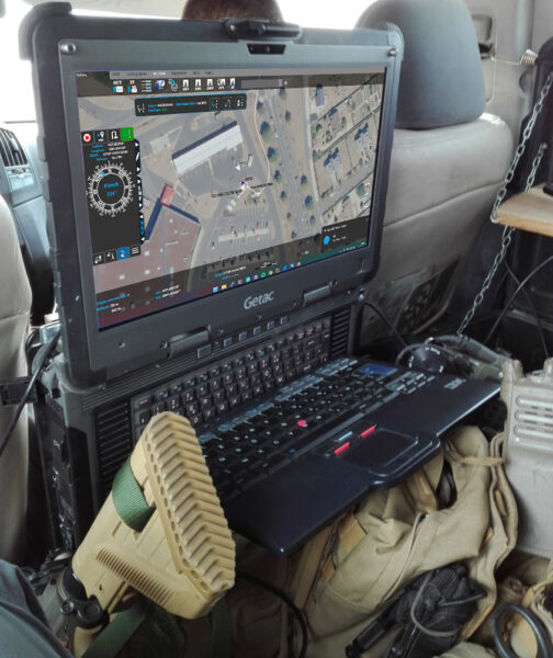
The NOMAD version is the “ground” version of the Delta Suite, running on Windows. It allows a tactical follow-up as close as possible to the events.

presentation

The DELTA SUITE NOMAD runs on Windows, and provides all the tools of the C2 version combined with advanced navigation and sensor management tools.

In addition to the basic features, the DELTA SUITE NOMAD offers a set of advanced features to optimize the use of external sensors (Laser Range Finder, AIS management, GPS management, inertial units management).

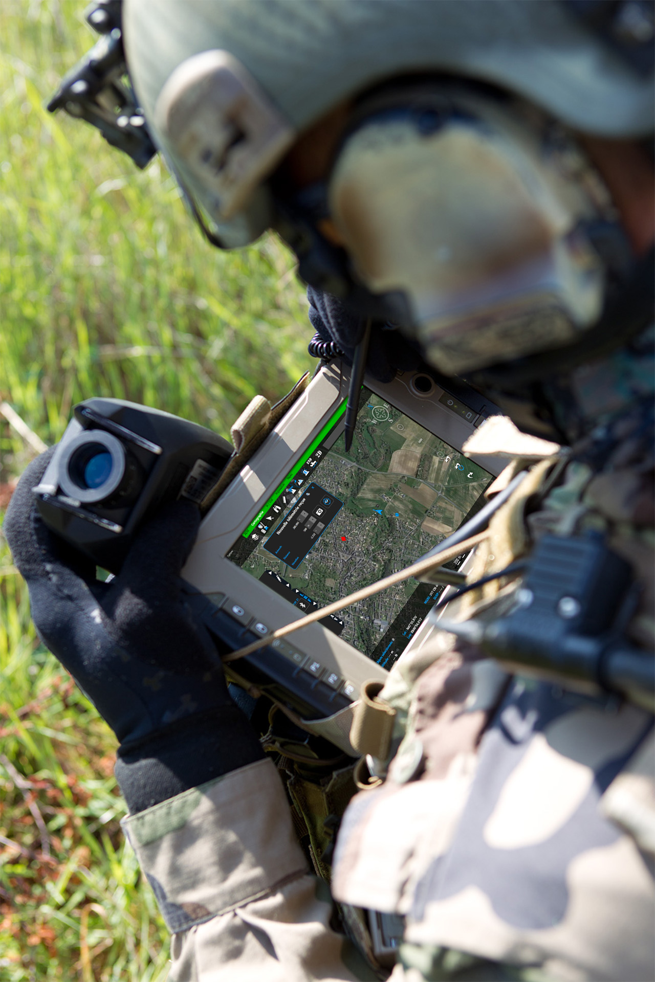
With its various sensor integrations and advanced applications, this version provides users with a complete tool that is close to the action.
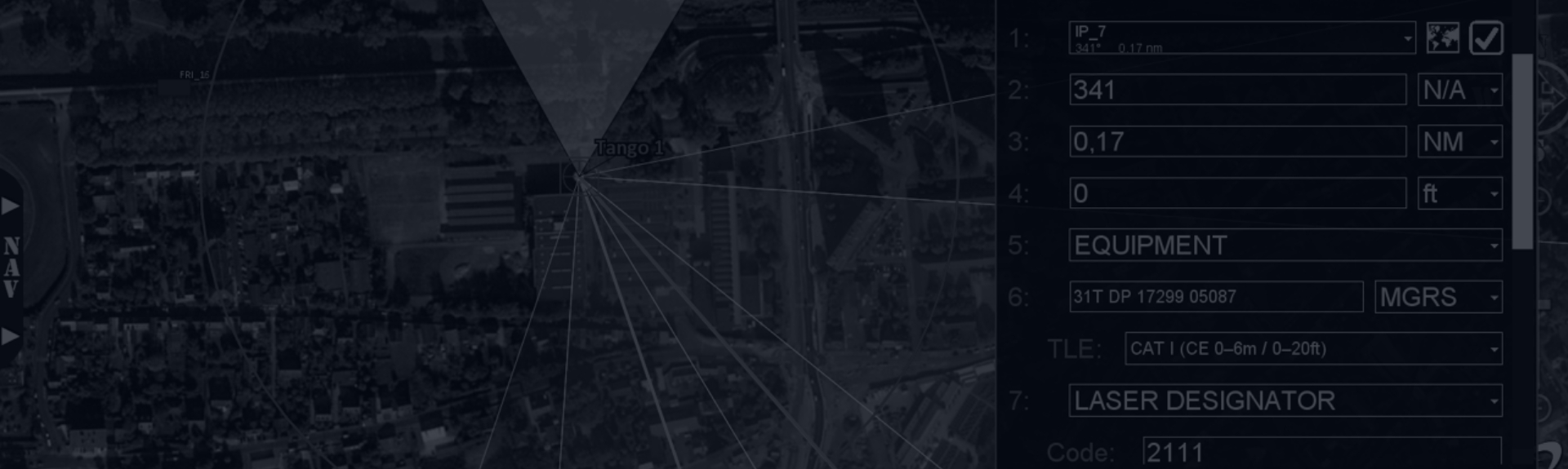
Download the datasheetchevron

“ CORE ” FUNCTIONALITIES

In order to allow a quick overview of the most important information, the user has permanent access to the following functionalities on his main display :

  • Display of coordinates (MGRS, long/lat…) and altitude, elevation (meter and feet)
  • Graphical scale (metric/imperial)
  • Local / Universal time
  • Map interaction tools
  • Drag and drop import capabilities of numerous geographic data formats (GeoTIFF, JPEG 2000, ECW, DTED/DMED, Shapefile, KML/KMZ, NITF, S57, USRP, ASRP, Mr Sid, AML, GeoPDF) and connection to web mapping services (WMTS, XYZ, TMS)
  • Drawing of vector objects
  • Layers Manager
  • Basic and advanced search tool
  • Slope profiles and line of sight calculation, geofencing tool
  • 2D / 3D view toggle

SPECIFIC APPLICATION “ IN/OUT ”: DATA EXCHANGE AND EXPORT IN MULTIPLE FORMATS

This specific business application provides the following functions :

  • Export of objects to any other user on the network
  • Import of objects sent by any other network user
  • Monitoring of items sent and peers
  • Export in multiple formats (SHP, KML/KMZ, JSON, GPX)
  • Snapshot of one or more layers
  • Import of cartographic and vector data by file
  • Configuration of mapping servers

SPECIFIC APPLICATION “ NAVIGATION ”

This specific business application provides the following functions :

  • Automatic connection and configuration of GPS
  • Retractable pull-out with all essential information (compass, heading, speed, distance to next waypoint)
  • Waypoint, route and point of interest management
  • Track recording
  • Trackback
  • Guidance to a moving object
  • Simulated GPS feature
Options Produit

Any questions, an issue?